Geography
Geography Curriculum Statement
What Geography looks like in Goodrich CE Primary School
Through our branches, a broad and balanced curriculum is provided to give our learners a range of skills, knowledge and experiences.
At Goodrich Primary school we adopt a skills and knowledge-based curriculum which uses building blocks to develop an understanding of Geographical Big Ideas using various themes e.g. climate. We encourage children to reference previous learning before developing that building block further in a cyclical learning approach. We base our Geography curriculum on Chris Quigley’s Curriculum Companion as it complements our know more, remember more approach to learning.
|
CURRICULUM INTENT |
Curriculum Intent What Geography looks like in our school.
This is our philosophy:
This is the knowledge and understanding gained at each stage:
By the end of EYFS pupils will:
|
|
CURRICULUM INTENT |
By the end of Key Stage 1 pupils will be able to:
By the end of Key Stage 2 pupils will be able to:
|
|
CURRICULUM IMPLEMENTATION |
Curriculum Implementation
Please refer to:
This is how it works:
This is what the adults do:
This how we support:
This how we challenge:
This how we ensure all children can access the curriculum:
What is Cultural Capital? The National Curriculum defines cultural capital as: ‘the essential knowledge that pupils need to be educated citizens, introducing them to the best that has been thought and said and helping to engender an appreciation of human creativity and achievement’. This powerful knowledge can be split into two categories: powerful subject knowledge and powerful personal knowledge. Powerful Subject Knowledge in Geography
Powerful Personal Knowledge in Computing
|
|
CURRICULUM IMPACT |
Curriculum Impact At Goodrich Primary School, we recognise the importance of Geography in every aspect of daily life. Our Geography Curriculum facilitates sequential learning and long-term progression of knowledge and skills. Teaching and learning methods provide regular opportunities to recap acquired knowledge through high quality questioning, discussion, modelling and explaining to aid retrieval at the beginning and end of a lesson or unit. This enables all children to build on their prior knowledge and develop as geographers.
This is what you might typically see:
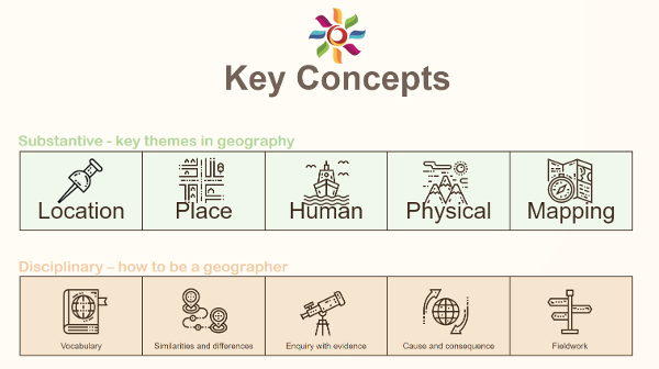
This is how we know how well our children are doing: We have identified substantive and disciplinary knowledge which is fundamental to the children’s development and understanding as Geographers. They accumulate this as they move through our school which then gives them a firm foundation to build on when they move on to KS3 and beyond.
This is the impact of the teaching:
|
Geography Progression Document
|
Our curriculum sets out progression in the form of three ‘Milestones’. The children work towards each Milestone for two years. During the first-year pupils attain an understanding of the skills set out in the Milestone and during the second year they develop an advanced or deeper understanding. Each Milestone contains a range of descriptors which provide details of the skills to be covered. Over a two-year period, students become more and more familiar with these details by exploring them in a breadth of contexts. This helps pupils to “know more” and “remember more.” |
|||
|
Links to learning in EYFS |
Understanding the World - People and Communities - Children talk about past and present events in their own lives and in the lives of family members. They know that other children don’t always enjoy the same things and are sensitive to this. They know about similarities and differences between themselves and others, and among families, communities and traditions.
Understanding the World - The World - Children know about similarities and differences in relation to places, objects, materials and living things. They talk about the features of their own immediate environment and how environments might vary from one another.
Mapping skills EYFS – Direction - Follow simple directions. Drawing maps - Draw and create their own maps using real objects, and/or pictures and symbols. Representation - Look at signs and symbols on different types of maps for example in school, and the local community. Using maps - Use a simple map with symbols to spot features in the school grounds or in the local community. Styles of maps - Real maps, electronic globes and maps, maps of the classroom/school, local town, park, zoo, museum etc, story maps.
|
Links to other subjects and curriculum areas |
Links between understanding of science and geography when discussing habitats and issues around climate change.
Using online simulations to explore ideas, using spreadsheets & databases to analyse and explore data and using the internet as a search tool to support learning all link to Computing.
Learning about different cultures and religions ties geography and RE closely together.
Exploring foods from different cultures and festivals links to DT and RE topics.
Understanding the culture and human geography of countries will almost always link to their history. |
|
|
|
||
GEOGRAPHY
Overview KS1 (Milestone 1)
|
GEOGRAPHY |
Year A |
Year B |
|
|
Mapping The World (MUST include Naming & locating the worlds 7 continents & 5 oceans) |
|
|
AUTUMN |
United Kingdom England (MUST include local fieldwork- devising map of the school grounds- both human & physical features. Use aerial photos) Scotland Wales & Northern Ireland |
London Edinburgh Cardiff Belfast |
|
SPRING |
Climate Weather |
Oceans |
|
SUMMER |
Australia Sydney Aboriginal People |
Australia Daintree Rainforest Great Barrier Reef |
Overview WOODPECKERS & OWLS KS2- Years 3&4 (Milestone 2)
|
GEOGRAPHY |
Year A |
Year B |
|
|
Describing Maps of the World 1 |
|
|
AUTUMN |
Europe: Rivers Population Mountains |
International Trade: Food Natural Resources Tourism |
|
SPRING |
Transportation: Cities National International |
Erosion: Rivers Coasts Management
|
|
SUMMER |
Landscapes: Rivers Weathering Mountains Climate Change The Water Cycle |
Earthquakes & Volcanoes: Plate tectonics The Pacific Ring of Fire Impact |
Overview PEREGRINES KS2- Years 5&6 (Milestone 3)
|
GEOGRAPHY |
Year A |
Year B |
|
|
Using Maps- Features Using Maps- Four figure grid reference |
|
|
AUTUMN |
Biomes & Climate Zones: Freshwater Tundra |
Ocean currents Biomes & Climate Zones: Marine |
|
SPRING |
North America South America Populations |
North & South America: Rivers Mountains |
|
SUMMER |
Biomes & Climate Zones: Taiga (MUST compare to local area, including fieldwork/ maps, plans & digital tech) Grassland Temperature Deciduous Forest |
Biomes & Climate Zones: Desert Ice Savana Tropical Rainforest |
|
|
MILESTONE 1 |
MILESTONE 2 |
MILESTONE 3 |
|
Mapping skills
|
Direction and location
Follow directions (Up, down, left/right, forwards/backwards) Follow directions NSEW
Drawing maps
Draw picture maps of imaginary places and from stories. Draw a map of a real or imaginary place. (e.g. add detail to a sketch map from aerial photograph)
Representation
Use own symbols on imaginary map. Begin to understand the need for a key. Use class agreed symbols to make a simple key.
Using maps
Use a simple picture map to move around the school; Recognise that it is about a place. Follow a route on a map. Use a plan view. Use an infant atlas to locate places. Picture maps and globes Find land/sea on globe. Use teacher drawn base maps. Use large scale OS maps. Use an infant atlas.
|
Direction and location
Use 4 compass points to follow/give directions: Use letter/no. co-ordinates to locate features on a map. Use 4 compass points well: Begin to use 8 compass points; Use letter/no. co-ordinates to locate features on a map confidently.
Drawing maps
Try to make a map of a short route experienced, with features in correct order. Make a simple scale drawing.
Representation
Know why a key is needed. Use standard symbols. Begin to recognise symbols on an OS map.
Using maps
Locate places on larger scale maps e.g. map of Europe. Follow a route on a map with some accuracy. (e.g. whilst orienteering) (e.g. Find UK or India on globe) Follow a route on a large scale map. Use large scale OS maps. Begin to use map sites on internet. Begin to use junior atlases. Begin to identify features on aerial/oblique photographs.
Use large and medium scale OS maps. Use junior atlases. Use map sites on internet. Identify features on aerial/oblique photographs. |
Direction and location
Use 8 compass points; Begin to use 4 figure coordinates to locate features on a map. Use 8 compass points confidently and accurately; Use 4 figure co-ordinates confidently to locate features on a map. Begin to use 6 figure grid refs; use latitude and longitude on atlas maps.
Drawing maps
Begin to draw a variety of thematic maps based on their own data. Begin to draw plans of increasing complexity.
Representation
Draw a sketch map using symbols and a key; Use/recognise OS map symbols. Use/recognise OS map symbols; Use atlas symbols.
Using maps
Compare maps with aerial photographs. Select a map for a specific purpose. (E.g. Pick atlas to find Taiwan, OS map to find local village.) Begin to use atlases to find out about other features of places. (e.g. find wettest part of the world) Follow a short route on an OS map. Describe features shown on OS map. Locate places on a world map. Use atlases to find out about other features of places. (e.g. mountain regions, weather patterns)
Use index and contents page within atlases. Use medium scale land ranger OS maps. Use OS maps. Confidently use an atlas. Recognise world map as a flattened globe. |
|
Investigate places This concept involves understanding the geographical location of places and their physical and human features
|
Ask and answer geographical questions (such as: What is this place like? What or who will I see in this place? What do people do in this place?). - Identify the key features of a location in order to say whether it is a city, town, village, coastal or rural area. - Use world maps, atlases and globes to identify the United Kingdom and its countries, as well as the countries, continents and oceans studied. - Use simple fieldwork and observational skills to study the geography of the school and the key human and physical features of its surrounding environment. - Use aerial images and plan perspectives to recognise landmarks and basic physical features. - Name, locate and identify characteristics of the four countries and capital cities of the United Kingdom and its surrounding seas. - Name and locate the world’s continents and oceans. |
Ask and answer geographical questions about the physical and human characteristics of a location. - Explain own views about locations, giving reasons. - Use maps, atlases, globes and digital/computer mapping to locate countries and describe features. - Use fieldwork to observe and record the human and physical features in the local area using a range of methods including sketch maps, plans and graphs and digital technologies. - Use a range of resources to identify the key physical and human features of a location. - Name and locate counties and cities of the United Kingdom, geographical regions and their identifying human and physical characteristics, including hills, mountains, cities, rivers, key topographical features and land-use patterns; and understand how some of these aspects have changed over time. - Name and locate the countries of Europe and identify their main physical and human characteristics |
Collect and analyse statistics and other information in order to draw clear conclusions about locations. - Identify and describe how the physical features affect the human activity within a location. - Use a range of geographical resources to give detailed descriptions and opinions of the characteristic features of a location. - Use different types of fieldwork sampling (random and systematic) to observe, measure and record the human and physical features in the local area. Record the results in a range of ways. - Analyse and give views on the effectiveness of different geographical representations of a location (such as aerial images compared with maps and topological maps - as in London’s Tube map). - Name and locate some of the countries and cities of the world and their identifying human and physical characteristics, including hills, mountains, rivers, key topographical features and land-use patterns; and understand how some of these aspects have changed over time. - Name and locate the countries of North and South America and identify their main physical and human characteristics |
|
Investigate patterns This concept involves understanding the relationships between the physical features of places and the human activity within them
|
Understand geographical similarities and differences through studying the human and physical geography of a small area of the United Kingdom and of a contrasting non-European country. - Identify seasonal and daily weather patterns in the United Kingdom and the location of hot and cold areas of the world in relation to the Equator and the North and South Poles. - Identify land use around the school. |
Name and locate the Equator, Northern Hemisphere, Southern Hemisphere, the Tropics of Cancer and Capricorn, Arctic and Antarctic Circle and date time zones. -Describe some of the characteristics of these geographical areas. - Describe geographical similarities and differences between countries. - Describe how the locality of the school has changed over time. |
Identify and describe the geographical significance of latitude, longitude, Equator, Northern Hemisphere, Southern Hemisphere, the Tropics of Cancer and Capricorn, Arctic and Antarctic Circle, and time zones (including day and night). - Understand some of the reasons for geographical similarities and differences between countries. - Describe how locations around the world are changing and explain some of the reasons for change. - Describe geographical diversity across the world. - Describe how countries and geographical regions are interconnected and interdependent |
|
Communicate geographically This concept involves understanding geographical representations, vocabulary and techniques
|
Use basic geographical vocabulary to refer to: • key physical features, including: beach, coast, forest, hill, mountain, ocean, river, soil, valley, vegetation and weather. • key human features, including: city, town, village, factory, farm, house, office and shop. -Use compass directions (north, south, east and west) and locational language (e.g. near and far) to describe the location of features and routes on a map. -Devise a simple map; and use and construct basic symbols in a key. Use simple grid references (A1, B1) |
Describe key aspects of: • physical geography, including: rivers, mountains, volcanoes and earthquakes and the water cycle. • human geography, including: settlements and land use. • Use the eight points of a compass, fourfigure grid references, symbols and key to communicate knowledge of the United Kingdom and the wider world. |
Describe and understand key aspects of: • physical geography, including: climate zones, biomes and vegetation belts, rivers, mountains, volcanoes and earthquakes and the water cycle. • human geography, including: settlements, land use, economic activity including trade links, and the distribution of natural resources including energy, food, minerals, and water supplies. • Use the eight points of a compass, four-figure grid references, symbols and a key (that uses standard Ordnance Survey symbols) to communicate knowledge of the United Kingdom and the world. • Create maps of locations identifying patterns (such as: land use, climate zones, population densities, height of land). |
Geography Assessment
|
GEOGRAPHY |
||||||||
|
BIG IDEAS |
INVESTIGATE PLACES |
INVESTIGATE PATTERNS |
COMMUNICATE GEOGRAPHICALLY |
|||||
|
Building Blocks |
Physical Features |
Location |
Human Features |
Physical Processes |
Human Processes |
Diversity |
Vocabulary |
Techniques |
|
|
|
|
|
|
|
|
|
|
|
|
||||||||
|
Milestone |
INVESTIGATE PLACES |
INVESTIGATE PATTERNS |
COMMUNICATE GEOGRAPHICALLY |
|||||
|
Physical Features |
Location |
Human Features |
Physical Features |
Location |
Human Features |
Physical Features |
Location |
|
|
1
|
Can identify the key features of a location to say whether it is a city, town, village, coastal or rural area. Know the difference between a human and physical feature. Can give an example of a human and physical feature within the UK. Can name the 4 countries of the UK. Can name the capital cities of the UK. Can locate the 4 countries on a map. Can name and locate the world’s continents and oceans. |
Can talk about similarities and differences between human and physical features of the UK compared to another country. Can identify seasonal and daily weather patterns in the United Kingdom. |
Can use basic geographical vocabulary to refer to: • key physical features, including beach, coast, forest, hill, mountain, ocean, river, soil, valley, vegetation and weather. • key human features, including city, town, village. |
|||||
|
2
|
Can name and locate counties and cities of the United Kingdom. Can identify human and physical characteristics, including hills, mountains, cities, rivers, key topographical features and land-use patterns; and understand how some of these aspects have changed over time. Can name and locate the countries of Europe and identify their main physical and human characteristics. |
Can name and locate the equator, northern hemisphere, southern hemisphere, the tropics of Cancer and Capricorn, Arctic and Antarctic Circle and date time zones. Can describe geographical similarities and differences between countries. |
Describe key aspects of: • physical geography, including: rivers, mountains, volcanoes and earthquakes and the water cycle. • human geography, including: settlements and land use. • Use the eight points of a compass, four figure grid references, symbols and key to communicate knowledge of the United Kingdom and the wider world. |
|||||
|
3
|
Can name and locate some of the countries and cities of the world and their identifying human and physical characteristics, including hills, mountains, rivers, key topographical features and land-use patterns; and understand how some of these aspects have changed over time.
Can name human and physical features within our local area. |
Can identify and describe the geographical significance of latitude, longitude, equator, northern hemisphere, southern hemisphere, the Tropics of Cancer and Capricorn, Arctic and Antarctic Circle, and time zones (including day and night). |
To describe and understand key aspects of: • physical geography, including:
To be able to use the eight points of a compass, four figure grid references, symbols and a key (that uses standard Ordnance Survey symbols) to communicate knowledge of the United Kingdom and the world. |
|||||
Geography Vocabulary
|
Geography Vocabulary |
||||||
|
Milestone 1 EYFS |
Milestone 1 Year 1 and 2 |
Milestone 2 |
Milestone 3 |
|||
|
human features physical features United Kingdom (UK) place city town rural map world globe countries daily weather hot cold farm house office shop |
atlas environment investigate locate ocean east west construct surrounding characteristics continent symbol grid reference surrounding vegetation factory compass north village coastal |
south environment characteristic locate seasonal equator North Pole South Pole beach coast river mountain hill soil valley |
hemisphere Artic Antarctic earthquake land use time zone topographical Tropic of Cancer Tropic of Capricorn volcano water cycle
|
|
aerial analyse biome climate depict distribute economic effectiveness energy food London Tube map minerals Ordinance Survey (OS) population sampling settlement systematic trade water supply |
|
Geography Recommended Reads/ Websites/ Apps
Recommended reads for KS1
 |
 |
 |
 |
 |
 |
 |
 |
 |
 |
 |
 |
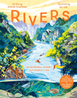
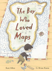
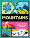
Recommended reads for KS2
 |
 |
 |
 |
 |
 |
 |
 |
 |
 |
 |
 |
|
Recommended Websites
First explorations - Met Office
Weather and climate in the UK | KS2 Geography | Year 3 and Year 4 - BBC Bitesize
Exploring locations - the seven continents - Years 1/2 - P2/3 - Geography Collection - BBC Bitesize
Let's explore the UK - BBC Bitesize
Cities of the UK | KS2 Geography | Year 3 and Year 4 - BBC Bitesize
What is an ocean habitat? - BBC Bitesize
What are human and physical features in geography? - BBC Bitesize
Cities, towns and villages - BBC Teach
Recommended Apps
Google Earth allows you to explore the entire world from above, using 3D terrain and satellite imagery of the whole globe. This means you can view 3D buildings inhundreds of cities around the world.

Barefoot World Atlas
Fly around the interactive 3D globe and discover the rich wonders of our planet. It is a show-stopping interactive app that allows children to explore an enticing, spinning world packed with animated icons, an ever-changing soundscape and interactive quizzes.


